I’m a lazy person and I’m not hiding it. I like automating tasks as much as possible so that I can work less do more in the same amount of time.
This past weekend I met Pedro Aznar, who works at Banco de Sabadell and is also the director of Applesfera. We’ve discussed briefly about the bank and the exciting times it goes through now that the BBVA public trade offer is over and the bright future it has. I don’t own any banking stocks in my portfolio, but I thought of buying some shares of Banco de Sabadell. So, being lazy, for my long-term portfolio I like using Dollar Cost Averaging (DCA) strategy to avoid timing the market.
The next day I was thinking if there is a way to use the same DCA strategy a bit different, as in taking profit of the short-term bad newsor dips when prices can drop few percentage points in a matter of days.
Doing what I like most, I quickly built an Excel file with a Power Query connection to Yahoo Finance API to get the Banco de Sabadell (SAB.MC on Yahoo Finance) stock prices for last 6 months and started doing some tests. To buy the dip I needed to decide on 2 things: 1) how big the dip is in days and 2) how big the dip is in percentages.
For the days, I decided that last 5 sessions (aka trading days) should be enough to consider it a quick dip, since after few days the stock usually recovers if the company is good enough. I’ll not get into more details here, that’s why “usually” word is in italic 🙂
For the dip percentages, it’s a bit tricky. One stock can go up or down 10% in 2 days and it’s ok, another stock can go up or down 2% and everything is taking profit like crazy. So I decided to make use of Average True Range (ATR) indicator expressed as a percentage of the current stock price. For example, the formula is: ATR/Close price*100. Considering January 16’s data, the ATR was 0.0711 and closed price was 3.24. Let’s play with the formula:
I rounded 2.194% to 4% for SAB.MC stock considering that if it moves 4% in 5 days, it’s good enough to get a piece of the cake.
Playing with the data in Excel I reached a point where I was satisfied with the results and needed a way to automate it. Again, 5 seconds to open Excel and refresh data is too long 🙂 so I decided to build an TradingView indicator that will give me BUY signals when price dips 4% from the highest closed price in the last 5 days.
What the script does
Inputs
Percentage below N‑days high (pct): the percent pullback from the recent N‑day high that defines the threshold.
Number of days to look back (sessions): how many daily bars are used to compute the recent close and low prices.
Days between BUY signals (cooldownBars): minimum number of bars (days) required between BUY signals. This is to avoid 5 buy signals in 5 days if the price drops like crazy every day.
Data allignment
The script reads daily close and low prices via request.security, so the N‑day close/low are based on trading days even when you view intraday charts.
closeD: daily close price
lowD: daily low price
Computed series
highestN: highest daily closeD over the last sessions days
lowestN: lowest daily lowD over the last sessions days
BUY logic
triggerLevel: highestN * (1 – pct / 100) – the threshold price that is pct% below the N‑day high.
The script uses ta.crossunder(close, triggerLevel) as the BUY trigger. A BUY label is generated when the bar close crosses from above to below the threshold.
A cooldown prevents repeated BUYs. After a BUY signal fires, the script ignores further BUY conditions until cooldownBars bars have passed. The script records the bar index of the last BUY and compares the current bar index to enforce the cooldown.
Visuals
The indicator plots highestN (red), lowestN (green), and the threshold (orange).
When a BUY is allowed by the cooldown, the script places a single BUY label at the bar where the condition occurred.
The final chart looks like below:
Why these design choices
Daily alignment reduces noise. Using daily closes for the high avoids overreacting to intraday spikes that do not reflect session strength. The N‑day high becomes a stable reference that updates once per day.
Threshold as a percentage of the N‑day high is intuitive. Traders commonly think in percentage pullbacks. Multiplying the N‑day high by (1 – pct/100) is simple, transparent, and easy to tune.
Close confirmation reduces false signals. Requiring the close to cross under the threshold filters out transient wicks that briefly touch the level but do not represent a sustained move. *If you prefer immediate entries on touch, you can change buy condition ta.crossunder(close, triggerLevel) to low <= triggerLevel
Cooldown prevents overtrading. Markets can linger below a threshold for several bars. The cooldown enforces a minimum spacing between signals so you evaluate each entry without being flooded by repeated alerts. This is especially useful on lower‑liquidity instruments or during volatile periods.
Concrete example for Banco de Sabadell on BME using 4% and 5 sessions
Input choices for the example: pct = 4 sessions = 5 cooldownBars = 5
Step 1 Compute the 5‑day high
Suppose the five most recent daily closes include a highest close of 3.372. That becomes highestN.
Displayed: the script will show the threshold around 3.237 if plotted and formatted to three decimals.
Step 3 Interpret signals
Close‑based BUY: a BUY is generated only when a daily close crosses from above to below 3.237. If an intraday low dips to 3.169 but the bar closes above 3.237, the script will not generate a BUY because it requires close confirmation.
Cooldown example: if a BUY fires on day index 100, and cooldownBars = 5, the next BUY can only occur on day index 105 or later. Any close‑under events between 101 and 104 are ignored.
How to tune the script for your trading style
More conservative entries. Keep ta.crossunder(close, triggerLevel) and increase cooldownBars to 5–10 days. This reduces false positives and limits entries during choppy periods.
More aggressive entries. Change the trigger to low <= triggerLevel to fire on the first touch. Reduce or remove the cooldown if you want every touch to be signaled.
Adjust percentage and lookback.
Smaller pct (1–2%) yields more frequent signals near the recent high; larger pct (3–6%) waits for deeper pullbacks.
Shorter sessions (3–5) reacts faster to recent price action; longer sessions (10–20) smooths the reference and reduces sensitivity.
The full script can be found below. You’ll need to start creating a new indicator in TradingView and paste the code to test it.
If you’re new to this post, start with the first post explaining the “Trade the Trend” Strategy.approach.
In early December 2025, SPDR redesigned its website and removed the monthly sector performance tracking feature, so December’s data is unavailable. Still, I briefly analyzed performance using the data from January through November 2025.
Investment Overview
Investing monthly across the 11 Sector SPDR ETFs, the total amount invested was $11,084.
Sector Allocation Summary
ETF
Sector
Total Invested
% of Portfolio
XLB
Materials
754.76
6.81%
XLC
Communication Services
1,100.05
9.93%
XLE
Energy
971.70
8.77%
XLF
Financials
875.60
7.90%
XLI
Industrials
1,139.35
10.28%
XLK
Technology
1,391.66
12.55%
XLP
Consumer Staples
862.99
7.78%
XLRE
Real Estate
683.95
6.17%
XLU
Utilities
1,193.36
10.77%
XLV
Health Care
1,055.15
9.52%
XLY
Consumer Discretionary
1,055.75
9.53%
Total
11,084.31
100%
Monthly investments:
End-of-Year Portfolio Performance
The portfolio’s cost basis stands at $11,191.08, with an unrealized gain of $943.08, representing +8.43%.
Dividends for 2025 are reported in the demo account only from July onward and were not reinvested. The reported dividend figures below reflect the available timeframe (July-December) rather than a full-year total.
Between August 25 and September 5, I tackled two separate thru hikes. The first solo adventure was the large GR 150 Volta al Cadí-Moixeró, a loop that wraps around the rugged Cadí-Moixeró massif in Catalonia. The second was a group hike enjoying the Cavalls del Vent route.
For the first hike, my plan was to hike the entire trail but skipping one section and do its 150.1 variant instead. The GR 150.1 variant is a high-mountain variant that crosses the Cadí-Moixeró ridge from Coll de Pal to Gósol, staying mostly above 2,000 meters and passing iconic peaks like Comabona and Vulturó of over 2,6000m elevation.
For this week, I decided to carry nearly all my food and camp in a tent whenever possible/allowed. Fully loaded, my backpack weighed around 21 kg. Here you can see everything I took with me: https://lighterpack.com/r/hda19z
Some prep-ing photos:
Day 1: Refugi de Gresolet to Camping Molí de Fórnols
The beautiful sunny day started strong with a peaceful forest path from Refugi de Gresolet to Coll de Bauma – a gentle intro to the day. But from there, things got… rustic. A 6+ km track (open to 4×4 cars) led me to El Collell, winding through beef cattle territory. Picture cows, cowbells, cowbells and cow excrement everywhere and cowbells. Watch your step, literally. Did I mention cowbells already?! More cowbells.
There’s a spring just about 1km before El Collell, but I wouldn’t recommend drinking from it, even filtered water. The proximity to livestock makes it questionable at best.
Found a nice post 5-10 min later and took a short break to recharge and take care of my feet.
Once past El Collell, the descent into Gósol was a treat: narrow paths through open fields and forested patches. Two springs – Font de la Roca and Font Terrers – offered clean water and a chance to cool off.
Before reaching Gósol, I took a detour to visit an old fort. It’s not jaw-dropping, but it’s worth the short climb for the views and a bit of local history.
Take the upper path here to visit the fort
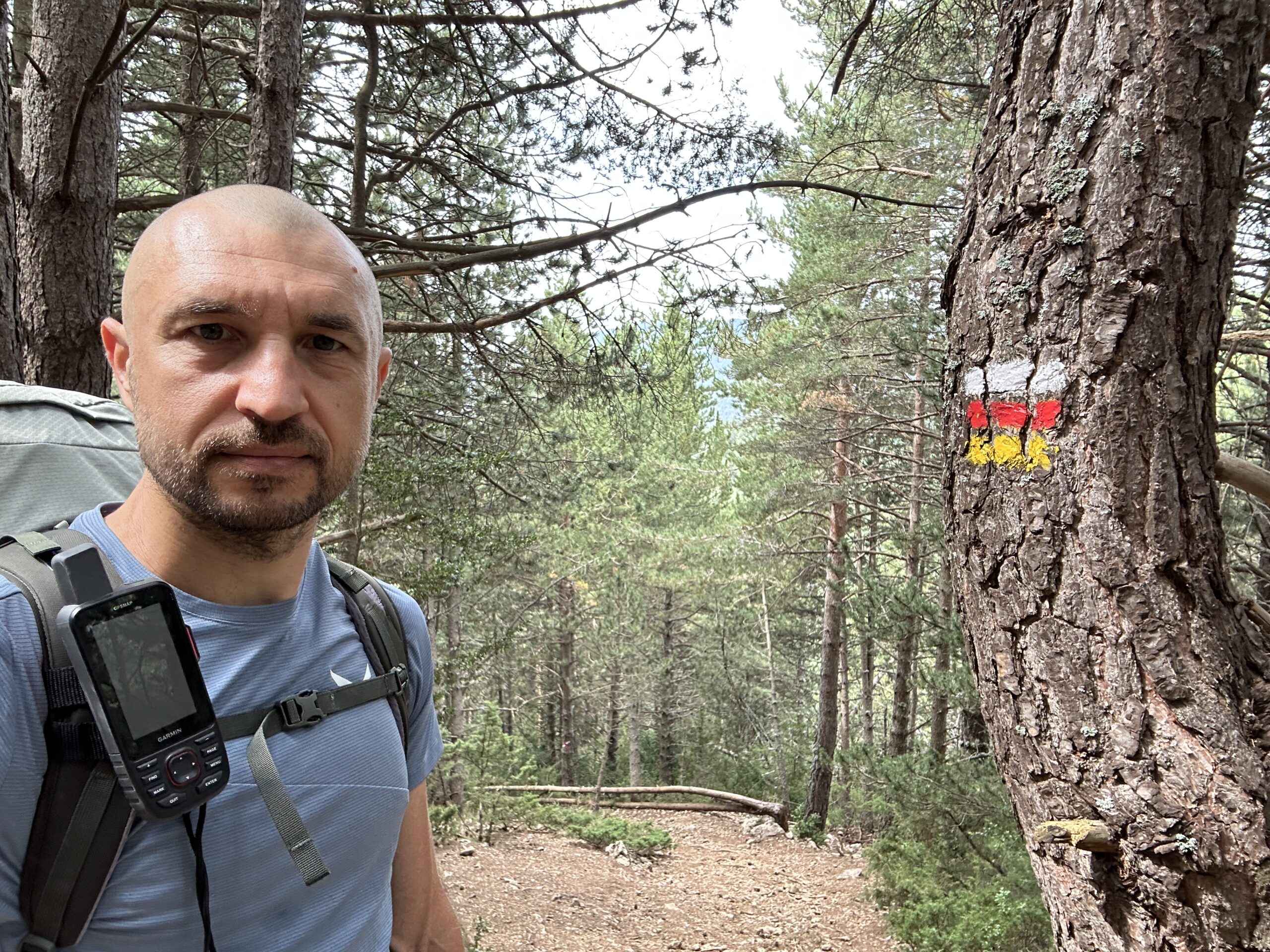
Overall, the GR markings for the entire day were extraordinarily good! But when entering Gósol, once you hit paved road, signs are completely missing so take a right and follow the road downhill. Eventually, the white and red trail marks reappear, guiding you past another nice spring that worths a mini bath after all this heat.
Gósol is a great place to recharge – rest your feet and mentally prep for the next climb. The trail ascends toward Ermita de Santa Margarida and leaves it well behind, and, while it’s not very steep, the heat and the 21 kg backpack (that was named “Crisis”, honoring midlife crisis) made it feel like a mini Everest.
From there, it’s mostly plain or downhill to Tuixent and onward to Fórnols. The path is smooth, scenic, easy forest paths with no technical challenges. Between Gósol and Tuixent, you’ll find a few springs, but between Tuixent and Fórnols – nothing. Plan your water stops accordingly.
Little by little, after about 1pm the clouds started gathering and by the time I was finishing my day, it started raining a bit. Just before reaching Fórnols, I passed by a camping site so I decided to call it a day and sleep there, Camping Molí de Fórnols.
The campsite is modest but functional:
Showers and toilets.
A laundry machine (no dryer. When I asked for it, people laughed like I’d asked for a spaceship).
Price: €8 for the tent + €8 per person + €0.66 tourist tax = €16.66 total
Camping Molí de FórnolsCamping Molí de FórnolsCamping Molí de FórnolsCamping Molí de Fórnols
Day 1 summary:
Distance: 31.15 km
Moving time: 8:17
Elapsed time: 10:26
Ascent: 1217m
Descent: 1442m
Min elevation: 1016m
Max elevation: 1909m
Day 2: Camping Molí de Fórnols – Vilanova de Banat
The night passed faster than expected – probably because my back was too busy screaming at me to notice the time. Lightning danced in the sky, but thankfully the rain RSVP’d “maybe” and never showed. The Crisis (my backpack, not a metaphor for my life… yet. Or…) had clearly bulked up overnight. Lastly, my Garmin GPSMAP 67i showed some rain and thunderstorms in the late afternoon. Great.
Breakfast was a gourmet affair: oatmeal with nuts, seeds, and peanut butter. Michelin-starred if you’re a squirrel. I packed up my tent, still half-soaked from condensation, and hit the trail at 9am under a sun that had clearly skipped its morning coffee and gone straight to full blast.
Little did I know, the first kilometer would be a vertical slap in the face. Narrow, rocky, and steep enough to make goats reconsider their life choices. It took me 40+ minutes to conquer that single kilometer. By the time I reached Fórnols, I looked like I’d been tumble-dried in a volcano. I swapped my soaked t-shirt for a linen long-sleeve white shirt, my tactical sun armor.
Unlike Day 1, this stretch of the GR150 was marked with what I can only assume were cryptic symbols left by bored children with paintbrushes. Half-visible white and red blurs, some marks that looked like they were made by someone blindfolded on a trampoline. At times, navigation became a guessing game with stakes.
After 2.5 km of sunburn and existential questioning, I reached Coll de Bancs. A spring and viewpoint all to myself. I took a hard-earned break, ate 2 home-made bars, and hung my second shirt out to dry like a flag of surrender. Now I had only one t-shirt left. After about 30 min I decided I need to move if I want to reach my planned stop.
The next 19 km were a desert-themed endurance test. No water sources. Just dry trails, relentless sun, and a Crisis that refused to lighten up. Turó Porredon and a few forest patches offered brief distractions, but mostly it was me vs. dehydration.
Reaching the first spring in La Seu d’Urgell felt like discovering Atlantis. I wandered the streets in search of food, dodging closed doors and confused locals seeing me. Or the Crisis. Eventually, I found a place open and a guy smoking outside who confirmed they had something “without meat.” I didn’t dare ask for vegan. I ordered two cokes and finally dropped the Crisis like it was hot (because it was).
Surprise: they had a vegan hamburger on the menu. Probably frozen since 2012, but I devoured it with some fries like it was made by angels.
After a two-hour break, I trudged the 5 km to Alás along a flat, soul-sapping road by the river El Segre. Refilled my bottles at a spring in Alás, because who knows what lay ahead. Spoiler: cow excrement. Everywhere.
My Garmin GPS showed the 1.5 hours till sunset alert. Kilometers later, reaching Vilanova de Banat late in the evening and finding no spring, no tent-worthy terrain I wandered off-route and found a few square meters of poop-free paradise. My planned stop was about 9 km from there, Ansovell.
Just as I started cooking dinner, the rain decided to make a dramatic entrance. I scrambled everything inside and finished cooking half-in, half-out of the tent like a culinary contortionist.
As I curled into my sleeping bag, the lightning show began. It was so intense I held the inReach device with the SOS button exposed, finger hovering like I was defusing a bomb. Just in case. Turns out, I fell asleep like that.
Day 2 summary:
Distance: 35.66 km
Moving time: 7:17
Elapsed time: 11:13
Ascent: 1553m
Descent: 1281m
Min elevation: 1730m
Max elevation: 1462m
Day 3: Vilanova de Banat – Martinet
Well well well… last night was something. Between us, I was scared. Like, “why did I think camping in a thunderstorm was a good idea?” scared.
Around 6am, I woke up to the gentle sound of rain tapping on my tent, gentle enough to cancel breakfast but not gentle enough to pretend I was in a cozy cabin sipping coffee.
I packed everything while staying inside the tent like a contortionist in a waterproof circus act, shoved the soggy tent into its designated misery pouch, and hit the trail by 7am. No sun, no heat – just rain, clouds, and cows. Lots of cows, again. My inReach forecast kindly informed me that I’d be enjoying rain, thunder, and a full-blown amber alert for the next 36 hours. Delightful.
But plot twist: one hour in, the rain stopped and the sun peeked out like it was testing the waters. Apparently, this region’s weather is like a moody teenager: thunderstorm, sun, thunderstorm, sun, repeat.
By the time I reached Ansovell, I was running on fumes and Snack #1. I set up my Jetboil café and enjoyed the chocolate in front of an old home. There is a spring in Ansovell, although it says it does not have sanitary checks. Apparently, the state needs to put this sign for all mountain springs, because there is no chloride added to the water, but local people use it with no problems. This time I added purification tablets, but in the next days I did not and did not have any issues.
In El Querforadat I stopped at the door of another uninhabited house and cooked my meal like a street chef with zero clientele. During my 30-minute meal break, the rain played peekaboo three times. I was not amused.
Trail markings? A joke. I got lost multiple times because someone forgot to finish their paint job. My GPS, bless its confused soul, kept recalculating and suggesting different routes but not the one I needed.
Midday brought a thunderstorm so aggressive it felt like nature was trying to pants me. I realized I wouldn’t make up the 9km I lost yesterday and reach my planned city, Bellver e Cerdanya. It was still 20+km away, and I was moving like a snail in a wind tunnel.
Thanks to the Salewa waterproof pants and jacket, I was not that wet, but I could feel my boots were soaked. After passing the tiny town of Cava (population: 12 goats and a mailbox), I knew I needed a dry place to sleep. Thanks to Lucia’s gifted 35L dry bag, everything inside the backpack was safe, but pitching a wet tent on a wet surface was a hard no. I called Lucia, who heroically booked me a room in Martinet. By 5pm, I was there, limping but victorious after the last 5km of steep-ish descent to the city.
Martinet, from Mirador de la Creu de Beixec
First order of business: shower. My feet looked like they’d been soaking in a haunted swamp. Salewa boots, meet your match. I washed my muddy clothes and hung them like modern art installations around the room. Hairdryer became foot dryer. Boots? Hairdryer lost the war. They were still wet at 9pm. Tent? Well, let’s say half-wet. But my feet? Starting to resemble human feet again.
Dinner was simple, cooked in the bathroom (no smoking sensors there, sorry).
The plan for tomorrow? TBD. Depends on whether the weather decides to be a friend or a troll.
Day 3 summary
Distance: 31 km
Moving time: 7:15
Elapsed time: 10:18
Ascent: 1286m
Descent: 1547m
Min elevation: 980m
Max elevation: 1602m
Day 4: Martinet. The day when the changed plan changed
I woke up this morning to a full-blown mutiny from my feet. They staged a silent protest sometime during the night and refused to cooperate unless I promised them a day off. So, I caved.
Day 4 was officially declared a hotel day in Martinet. I paid another huge amount of money for one more night, partly out of pity for my soles, and partly because the weather forecast was throwing heavy rain tantrums over the exact places I was supposed to hike through.
With the skies threatening and my feet sulking, I turned my attention to a noble cause: lightening Crisis. The strategy? Eat everything I can. I treated myself like a bottomless pit and Crisis like a pantry on clearance. Mission accomplished: Crisis now weighs less and I weigh… well, let’s not talk about that.
Originally, I had grand plans to tackle the GR150.1 variant. But with the Cavalls del Vent group hike starting on Monday from Refugio Gresolet, that plan evaporated faster than my motivation to walk in the rain. So I reverse-engineered the next few days to make sure I’d arrive at Gresolet on Sunday, with dignity intact.
Knowing that wild camping spots might be scarce, I booked a hut (Refugio de Rebost) and a campsite (Camping Bastareny). Refugio Gresolet I already had booked before. No more playing hide-and-seek with flat ground and the cows.
The new plan:
Friday: Bus from Martinet to Alp (the only reachable town by bus), then a 20+ km hike through Masella ski station to Refugio de Rebost.
Saturday: A gentle 10 km stroll from Rebost to Bagá. Honestly, calling it a hike feels like lying – it’s more of a walk to buy a donut.
Sunday: The final leg, 15 km from Bagá to Refugio Gresolet. Easy, breezy and some ascent.
After creating the new courses on the Garmin GPS and giving Crisis a much-needed diet, I emerged from my cozy burrow for a walk with my cousin and his wife, who changed their plans and passed through Martinet on their way to Andorra. Perfect timing, perfect company, and perfect excuse to eat more snacks.
Tomorrow, the trail resumes. But today? Today was about rest, recalibration, and Crisis finally learning her place.
Day 5: Alp – Refugio de Rebost
Today was finally a real hiking day. No more lounging in hotels pretending to be a potato. I had everything prepped the night before, so this morning was just a quick toss of toiletries into Crisis and off I went.
Checked out at 7am and treated myself to a local vegan breakfast at the corner bar: bread with olive oil and tomato sauce. Simple, not-very-delicious (the oil was a bit rancid), and just smug enough to feel like I was doing something good for my body. Espresso, of course, because hiking without caffeine is just walking with regrets.
Waiting for the bus……with some scenery
The bus to Alp left at the planned time. Good job Alsa! I knew it was going to be an adventure when I spotted the vomit bags tucked neatly at the entrance. Nothing says “scenic mountain transit” like the looming threat of motion sickness. Luckily, no incidents on board during the short ride.
Twenty minutes later, we arrived in Alp. I grabbed Crisis, my sleeping mat, and hiking poles, then stopped at the bus station searching on the Garmin handheld where to refill my water bottles. I was so focused on following the GPS navigation that I left the mat and poles behind like a breadcrumb trail for someone else’s hike. Fifteen minutes into the hike, I took off my first layer and realized my gear was gone. Cue dramatic sprint back to the station, no sign of them. Some lucky soul out there is now cruising the trails with a gently used sleeping mat and a pair of top-notch hiking poles – formerly mine, and once a thoughtful gift from Lucia, my gear guardian angel. She made sure I was fully equipped… until I decided to donate them to the universe via forgetfulness. May they treat them better than I did.
Camping plans? Suddenly very theoretical. I figured I’d ask the folks at Refugio de Rebost if they had a mat I could borrow for two nights. If not, I’d skip tomorrow’s camping and head straight to the next hut. Flexibility is key when your gear decides to ghost you.
About 3 km in, the GR 150 track veered off the paved road and into a forest trail. From there, it was 10–12 km of pure uphill through ski slopes and alpine beauty. The scenery was stunning, like hiking through a postcard, if postcards came with burning calves.
At Coll de Pal, the descent began and I entered cow territory. Let’s just say the cows were unimpressed by my presence. The only highlight of that section was almost closed to the hut, the Mirador dels Orris, a viewpoint that made the whole descent worth tolerating.
Finally, I reached Refugio de Rebost around 3-4pm. Too late for lunch, but the kind souls there whipped up some pasta for me anyway. And yes, they had a mat! Crisis was relieved. I was relieved. The camping gods smiled upon me. Nice day overall, see the movie below for some short scenes from the day.
After a cold shower and a moment to decompress, I sat outside with a view of the majestic Pedraforca massif, feeling like the day had thrown everything at me and I’d still come out ahead. Afterwards, I spent a lot of time catching up with the loved ones via messaging apps.
Tomorrow, I walk. To buy a donut. Stay tuned.
Day 5 summary
Distance: 22.05 km
Moving time: 4:51
Elapsed time: 6:02
Ascent: 1235m
Descent: 762m
Min elevation: 1155m
Max elevation: 2109m
GR150 signs today? Don’t get me started…
Day 6: Refugio de Rebost – Camping Bastareny
Today’s hike was more of a glorified stroll: the kind of day where you tell people you’re “on a thru-hike” but secretly you’re just walking to the store. From Refugio de Rebost to Camping Bastareny: a modest 10 km, mostly downhill. After the breakfast, I let everyone else pack and leave like proper hikers while I took my sweet time to enjoy the views, retrieved the sleeping mat from the hut guardian, and set off with zero urgency.
The descent started off promising…
Until the GR150 decided to take me through what I can only describe as a retired riverbed; a rocky, tangled mess of trees, shrubs, and spider webs that screamed “no one hikes here unless they’re lost.” For 5 km, I played a game of “don’t twist your ankle” while Crisis bounced around like she was auditioning for a rodeo.
Just when I was ready to file a formal complaint with Mother Nature, the trail spit me out into the peaceful front yard of Santuari de Paller. A cozy little sanctuary that looked like it was designed for barbecues and weekend getaways, not sweaty hikers emerging from the wilderness. Definitely worth pinning on the map for future non-hiking visits.
From there, the trail climbed a bit, but at least the rocks were gone. The sun, however, took center stage. I already had a solid tan, so the extra UV felt like nature’s way of saying, “You’re welcome.” As I got closer to Bagà, I started seeing trail runners; sleek, fast, and armed with hydration flasks. They looked at me and Crisis (now sporting two water bottles like saddlebags) with a mix of curiosity and concern. I must’ve looked like I was preparing for a desert crossing.
I reached Bagà in under two hours of actual walking. Took a long coffee break in the town center. Crisis, now lighter than six days ago, didn’t complain once. I grabbed a slice of coca (Catalan dessert, not the other thing), did a victory lap around the rambla, and headed toward the camping site.
Then came the dreaded 1.5 km slight ascent on paved road. I don’t know who invented asphalt, but they clearly weren’t thinking about hikers with tired feet and philosophical grudges against pavement.
At Camping Bastareny, I was assigned the farthest spot from the showers and toilets. I thought, “Nice, quiet corner.” That optimism vanished around midnight when nature called and I had to embark on a mini expedition just to pee.
Here’s my tent, Salewa Micra II. Looking good, isn’t it? 🙂 Fun fact: first time, more than 30 min to assemble. Today, 6 min, even on a low speed. Quick and easy if you look at the images and don’t ignore the colors of the aluminum poles 😀
The camping itself? Meh. Shower cabins with missing parts, toilets with mystery mechanics, and with toilet paper outside the actual meditation cabins, as if someone knows beforehand how paper they’ll need.
There was a massive laundry machine that looked impressive but never moved. Charging my phone and GPS took twice as long, probably powered by the same system that runs the showers.
Price: €22.66. Tourist tax was €0.66. The remaining €22? The tent €15 and electricity €7.
Verdict: Would not recommend unless really necessary.
The rest of the day was sunny and slow. Lunch. Two snack breaks. Dinner. And still some time left. I went to bed early, but my body wasn’t tired enough to cooperate. So I lay there, listening to the distant hum of other campers and wondering why the laundry machine was so big.
Tomorrow, the final stretch to Refugio Gresolet. Let’s hope it comes with fewer rocks.
Day 6 summary
Distance: 10.38 km
Moving time: 2:15
Elapsed time: 4:10
Ascent: 256m
Descent: 1066m
Min elevation: 769m
Max elevation: 1736m
Day 7: Camping Bastareny – Refugio de Gresolet
Woke up early. The campground was cloaked in darkness, and I half expected someone to offer me coffee. But no rush, this was the last day of my thru hike, and I was determined to savor every moment, even if it meant a cold shower that felt like hugging an ice sculpture. (For the record: I’ve been doing cold showers since spring. It’s not a mountain hut thing. It’s a “Lucia did some investigation and it’s healthy so now I’m committed” thing.)
Breakfast was a backpack-emptying ceremony: two ratios of oatmeal (don’t ask me what a ratio is, I just eyeball it), coffee, chocolate, and a homemade energy bar. Tent packed for the last time. Backpack zipped. And suddenly: space. Like, actual empty space.
To rejoin GR150, I was supposed to walk 1.5 km downhill to Bagá and then 1.5 km uphill again. But let’s be honest: not even in the name of the rain god was I going to do 1.5 km of paved road again just to do another 1.5 km back on another path. So I took the asphalt road uphill, which looked like it would intersect GR150 in about 1 km. Spoiler: it did.
The trail quickly dove into forest territory. While not on the GR150 yet, there were no marks at all, so very quickly there where a forest road and path and I had to choose: lower path or upper path? The lower one looked nicer so I took it. Later on I found myself on a path so unused it felt like I was part of a Spartan race. Take the upper road here if you ever find yourself on this road.
Font Nostra
From here to Font Vella, the trail was a mix of stunning forests, charming rivers, and an aggressive spider population to web me into their ecosystem. I used a stick to clear the way but still walked into some webs.
Font Vella itself? A gentle trickle. Hydration: yes. Water pressure: not so much.
At Font Vella, I had two choices: GR150 forest road or the SL trail shared with Cavalls del Vent. I chose the SL trail because it looked nicer, and it was. No regrets.
Lunch at Coll de Bauma was a culinary throwback: rice with mushrooms and veggies, prepped a week ago and still tasting like victory. Honestly, it was amaztastefull (even with no salt, I finished it 3 days ago).
From Coll de Bauma to Refugio Gresolet, I retraced my Day 1 steps but downhill this time. There’s also a forest road alternative, so I took it just to compare. Verdict: both are solid, but now I’ve got options for next time.
Day 7 summary
Moving time: 4:16
Distance: 15.43 km
Elapsed time: 5:11
Ascent: 934m
Descent: 510m
Min elevation: 814m
Max elevation: 1583m
Trail Notes & Tips
Navigation: GR markings can be unreliable in some sections. Keep a GPS or offline map handy.
Water: Springs are frequent until about 1500m elevation. Upper altitudes, plan your ratios accordingly.
Terrain: Mostly forest and pasture (except very specific rocky sections), with a mix of dirt paths and 4×4 car-accessible tracks.
Wildlife: Expect cows. Lots of cows. Had one encounter with a group of wild bears. Did not encounter any dogs or other animals.
Gear: A heavy pack makes even gentle climbs feel brutal in the heat. Pack smart. Eat less 🙂
And that’s it. The end of my solo GR150 adventure. Well, almost. I still owe the trail a visit to GR150.1. But that’s a story for another time.